Kansas Association of Mappers

Lunch and Learn Webinars

One of KAM's core missions is to help our members develop their skills through continuing their education. To that end, we started a new webinar series in 2021 dubbed "Lunch and Learn" in which we bring in experts on topics of interest who share their knowledge with the group.

Lunch and Learns are always free! Just register to get the webinar link. For past Lunch and Learns, view the full YouTube playlist or find the individual presentation below.

UPCOMING Lunch and Learns 2024

APPLICATIONS OF GEOAI IN AN APPRAISAL SETTING

12pm - 1pm, Wed, September 25, 2024

In 2019 the Shawnee County Appraiser's Office spent $11,000 to an outside company to do change detection on properties in the county returning a list of items that while advertised as 'multi-millions of dollars' had to be crosschecked by hand by the Appraisers team and ended with a net property list of unpermitted property to the tune of roughly $90,000 in tax revenue. This was initially an attempt to do something similar with similar levels man-hours but using self-learning tools to do the heavy lifting in finding the properties while only needing to spend a third, and subsequently a tenth, of the price to do the same. The project as a whole has returned results that suggest a number of intriguing avenues of attack going far beyond the original concept.

Presenter: Andrew Schappert, Shawnee County

SIGN UP HERE

Previous Lunch and Learns

July 2023

Marvelous Maps - A Mappy Adventure

12-1 pm, Wednesday, July 26, 2023


Watch the recording


Maps are not just simple tools, they are evolutionary constructs that humanity requires to function. Research shows that all people use cognitive maps to function day-to-day, to organize their experiences, and to help determine future behavior. Painted, printed, or even digital maps are just an extension of this biological function. For thousands of years people around the world have crafted marvelous maps, for a plethora of purposes. This presentation examines why maps are imperative for humanity to thrive and explores unique maps that have changed our collective trajectory.

Presenter: Nikolas Smilovsky, Bad Elf

Dr. Smilovsky is the GIS Solutions Director for Bad Elf, a GNSS technologies company. Additionally, he is a faculty member and instructor at Arizona State University. Dr. Smilovsky is a certified Geographic Information Systems Professional, a certified Arborist, and a Part 107 certified UAV pilot. As a geospatial evangelist, custom geospatial solutions provider, and geographic researcher Dr. S is widely versed in all things geodetic and is a geoholic!

Moderator: Andrew Schappert, KAM Education Committee

JUne 2023
State of the State: GIS in Kansas State Agencies

Watch the recording


Kansas is fortunate to have a wide presence of GIS resources at the Kansas agency level. This breakout session will be a series of lightning talks by various state agency GIS gurus. Each agency will highlight GIS topics such as: footprint, infrastructure, application, data and major initiatives.


Presenters: Eileen Battles, Kansas Data Access and Support Center, Sherri Chaturvedi, Kansas Department of Labor, Darci Paull, Kansas Forest Service, Katie Goff, Kansas Water Office, Nolita LaVoie, Kansas Department of Health and Environment, James Stewart, Kansas Department of Transportation, and Justin Jones, Kansas Department of Wildlife and Parks


Moderator: Ryan Howell, KAM Education Committee


MAY 2023
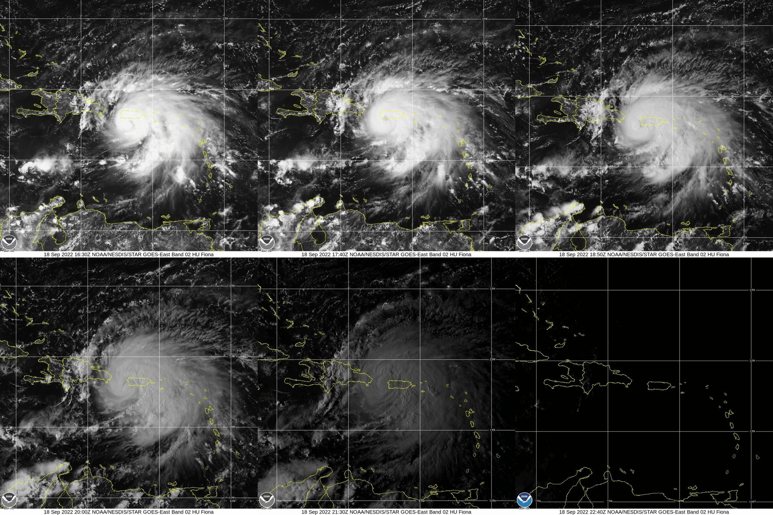
Measuring Hurricane Fiona's Impact from a Surveyor's Perspective

https://upload.wikimedia.org/wikipedia/commons/f/fc/Fiona_Puerto_Rico_landfall.gifWatch the recording

Hurricane Fiona made landfall on the Island of Puerto Rico on September 17-19, 2022. Ten days later Prairie Engineers received an emergency response task order from the US Army Corps of Engineers to send surveyors to the island.

In this presentation the audience will hear about the steps taken to plan and mobilize for deployment in the aftermath of Fiona, what the surveyors encountered upon arrival, obstacles and challenges overcome in course of performing the surveying and mapping tasks. The audience will see a close look at the damage to transportation infrastructure and changes to the coastal bathymetry. Presentation concludes with lessons learned from 3+ decades of providing geospatial services for emergency response.

Presenter: Scott Perkins, GISP, Prairie Engineers
Moderator: Sherri Chaturvedi, KAM Education Committee


APRIL 2023
COMMUNICATING GIS VALUE TO LEADERSHIP

Watch the recording


Learn about how you can effectively demonstrate and communicate the value that GIS brings to your organization. This session is intended to support GIS Managers and GIS professionals who want to grow and expand the impact and influence of GIS in their organization.


  • Identify decision makers and spur investment in GIS.
  • Get the right people motivated to adopt new GIS capabilities.
  • Communicate GIS ideas effectively for successful implementation.


Presenter: Matt Hoehn, Account Manager, Esri

Moderator: Amy Roust, KAM Education Committee

March 2023
GIS Response Operations During Emergencies

Watch the recording

Natural disasters can strike at any moment, and their impact can be devastating. Preparedness is crucial to ensure that individuals and communities can respond effectively to natural disasters. Additionally, it involves educating people on what to do during an emergency and how to access information and assistance. By being prepared, people can respond quickly to a disaster and minimize the impact on their lives and communities. We as GIS professionals also need to be prepared to provide quick and accurate information. This Lunch and Learn will be the initial discussion for implementing a statewide collaboration for GIS Response Operations during active disasters. We will discuss the want/need for data templates and operating procedures to use during active emergencies.


Presenters: Mark Schmidt and Pam Dunham, Butler County GIS
Moderator: Andrew Schappert, KAM Education Committee


August 2022
CYBERSECURITY IN ARCGIS

Watch the recording

Join us for this virtual workshop on how to keep your ArcGIS content, data, and users safe and secure in an insecure world. We'll examine the various dimensions of web GIS (in ArcGIS Enterprise, ArcGIS Online, and ArcGIS apps), and discuss how to build a comprehensive GIS security strategy. Along the way, you'll learn concrete steps you can take to secure your organization now, and key considerations to make for the future.

Presenter: Scott MacDonald is a solution engineer at Esri who guides state government agencies across the Midwest in their use of ArcGIS and spatial infrastructure. He joined the Esri St. Louis office in 2021 after four years on the ArcGIS Enterprise development team in Redlands, California.

Moderator: Dan Goff, KAM Education Committee

May 2022
Why pursue the GISP Designation?

Watch the recording

Individuals attending this session will receive information on the various facets of a professional career, especially from a geospatial perspective. Included will be a discussion of certification and professional credentials in general, and the GISP specifically, and how this area can help an individual succeed early and throughout one's career. GISPs who may have questions about renewing their certification are also encouraged to attend.

Presenter: Tony Spicci, Executive Director, GIS Certification Institute
Moderator: Cesalea Osborne, KAM Director


April 2022
ArcGIS Field Maps: One App to Rule Them All

Watch the recording

Is your organization currently using ArcGIS Collector, Explorer, or Tracker? If you answered ‘yes,’ this Lunch and Learn is a must-attend! ArcGIS Field Maps integrates the capabilities of these and other classic apps and streamlines the process of mobile collection and inspection. The companion Field Maps web app simplifies configuring the web maps you own and introduces new capabilities such as smart forms and offline map configuration. Join us to learn how Esri is unifying field workflows and mobile device management with ArcGIS Field Maps.

Presenter: Nicole Grams, Esri
Moderator: Erika Stanley, KAM Education Committee

March 2022
Working with drones, imagery, and machine learning using ArcGIS

Watch the recording

Learn about Esri's complete end-to-end drone mapping software, designed to revolutionized imagery collection. Automate repeatable drone flights. Create and view 2D & 3D outputs on the web. Discover insights about your project, track changes, conduct inspection, measure volumes, and elevations, all in the cloud. As well as combine powerful built-in tools with machine learning and deep learning frameworks to automatically detect and extract features from your project.

Presenter: Chase Fisher, Esri
Moderator: Katlynn Decker, KAM Education Committee


January 2022
Using the ArcGIS JavaScript API for mapping sewer flow monitoring sites

Watch the recording

This Lunch and Learn will showcase using the ArcGIS JavaScript API for mapping and data display in a sewer flow monitoring application. I will demonstrate using a JSON configuration file to load various map content (GEOJSON files, ArcGIS map services, KML layers, Fulcrum data) for multiple clients, including a visual tool to create and edit this configuration file.

Sewer flow monitoring consists of placing a monitor with sensors in a manhole to monitor multiple conditions and report that data to a server at a regular interval. For example, sensors attached to the monitor will collect Depth and Velocity data and an integrated camera will take an image of the manhole flow and the monitor will send that information to a server every 5 minutes.

Then, I'll show a custom "dashboard" application, that integrates images, charts and a "play mode". Lastly, I'll highlight a virtual rain gauge application.

The technical side of this Lunch and Learn will show using the esriRequest method to call PHP to query a MySQL database and create GEOJSON layers dynamically and the integration of Chart.js (JavaScript library) for graphing.

Presenter: Robert Meier, GIS Analyst for TREKK Design Group, LLC
Moderator: Amy Roust, KAM Education Committee

November 2021
What's Involved with Getting Involved in KAM?

Watch the recording

This is an encore presentation of our conference panel discussion focusing on the ways that KAM members can become more active in the organization. Each member of the panel is a current or previous committee chair who will share their experiences and answer attendee questions. We'll include an overview of all eight standing committees and, time permitting, the Executive Board's roles and duties. Our goal with this conversation is to encourage greater participating so that we have representation from as many different industries and experience levels as possible.

Amy Roust, moderator
Lee Allen, Pamela Cannon, Cara Mays, Erika Stanley, and Lisa Olson, panelists 

OCTOBER 2021
MAKING YOUR APPS ACCESSIBLE TO EVERYONE

Watch the recording
View/Download the PowerPoint slides

How do people living with disabilities access your web content? What can we do as mappers to make our web content more accessible? This webinar will cover guidelines and best practices for app customization to allow everyone equal access to use your ArcGIS web applications successfully.

Presenters:

  • Klara Schmitt, Esri UX/UI designer for Esri on ArcGIS Hub who has a passion for web accessibility
  • Nicole Grams, Esri Solution Engineer

May 2021

ArcGIS Field Maps

This webinar will provide an introduction to ArcGIS Field Maps, an all-in-one app that combines the capabilities of Explorer, Collector, and Tracker. This app helps organizations use data-driven maps to help fieldworkers perform mobile data collection and editing, find assets and information, and report their real-time locations.

Presenter:

  • Chase Fisher, Solution Engineer - Local Government (Esri St Louis)

© 2023 Kansas Association of Mappers | kamappers@gmail.com | PO Box 3788 | Lawrence, KS 66046-0788 | Site DisclaimerJoin us on LinkedIn!

Powered by Wild Apricot Membership Software